|
|
Akrotiri & Dhekelia
Sommaire
- Capital :
- Coordinates (1) :
34°50 N 33° E / 35° N, 33°75 E
- Population : 4200 inhabitants
- Area : 254 km2
- ZEE (3) : 0 km2
- Currency : Cypriot pound
- Population density : 16.5 hab/km2
|
Geography
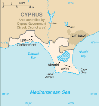
Akrotiri and Dhekelia are two military bases located on the South of Cyprus, in the Mediterranean Sea are under British sovereignty.
Top |
Localisation
34°50 N 33° E / 35° N, 33°75 E (1)
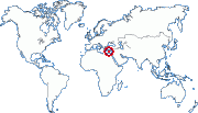
Zone : Europe
Top
|
History
After Cyprus' independancy in 1959, Akrotiri and Dhekelia remained under British direct. UK had planed for restituting a part of its Sovereign Base area (equal to 117 km2) to Chypre — mainly a part of Dhekelia — in case of reunification by the United Nations plan at its entrance in the UE. However this plan was rejected by Greek-Cypriots in April 2004 and thus this measure was not carried out.
Top
(1) These coordinates are approximate.
(2) Pour ce qui est des TAAF et des îles éparses, ce nombre varie trčs souvent. Leur population donnée ici n'est donc qu'une approximation trčs imprécise fournie ŕ titre purement indicatif.
(3) ZEE : Zone économique exclusive. Ces chiffres sont approximatifs.
|
|

 Akrotiri & Dhekelia