|
|
Rockall
Sommaire
- Capital :
- Coordinates (1) :
57° N 13° W
- Population : uninhabited
- Area : 0.0750000029802322 km2
- ZEE (3) : 0 km2
- Currency :
- Population density : 0 hab/km2
|
- Administration :
Rockall is administratively linked with Outer Hebrides. Therefore the rock is part of the United Kingdom.
Top
|
Geography
Rockall is more than 200 miles (370 km) West from Hebrides (archipelago near to Western Scotland). This tiny steep rock is 19 meters in height and its basis is about 25 m per 30. The see is often rough and thus Rockall is rarely accessible. A little lighthouse on the top of the islet lights up the surrounding area when it does not break down through lack of maintenance... The todays light operates with bateries which must be changed every years by specialists who flight to the rock twice a year.
The continental shelf around would be likely to contain natural gas.
Top |
Localisation
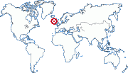
57° N 13° W (1)
Zone : Europe
Top
|
History
Several shipwrecks took place in Rockall's area : a Spanish merchant ship founded here in 1686, survey vessel Leonidas in 1812 (250 dead), Helen of Dundee in 1824 and the steamer "SS Norge" in 1904 (635 dead, 160 surlived ; the wreck was located off Rockall in 2003).
Rockall was claimed by United Kingdom. In 1955 a British went on Rockall thanks to an helicopter so as to plant the Union Jack on the summitt of the rock.
In 1959 the current lighthose was destroyed by heavy sea. In 1972 a new light was built up on the top of Rockall. The same year Rockall became part of the UK.
In 1997, Greenpeace occupied the rock for 42 days which was temporarily renamed Waveland. In 2005 one amateur radio visited Rockall.
Ireland, Denmark (through Feroa islands) , Eire and then UK have acceded to the United Nations Convention on the Law of the Sea which stipulates that rocks without human habitation or economic life shall have no exclusive economic zone. Ireland, Iceland and Denmark do not claim the islet because it doesn't count as far as economic zones are concerned. Today claims remain about bordaries of the continental shelf near Rockall between these four states.
Top
(1) These coordinates are approximate.
(2) Pour ce qui est des TAAF et des îles éparses, ce nombre varie trčs souvent. Leur population donnée ici n'est donc qu'une approximation trčs imprécise fournie ŕ titre purement indicatif.
(3) ZEE : Zone économique exclusive. Ces chiffres sont approximatifs.
|
|

 Akrotiri & Dhekelia