|
|
Anguilla
Sommaire
- Capital :
The Valley
- Coordinates (1) :
18°15 N, 63°10 W
- Population :
13000 inhabitants
- Area : 102 km2
- ZEE (3) : 0 km2
- Currency : East Caribbean dollar
- Population density : 127.5 hab/km2
|
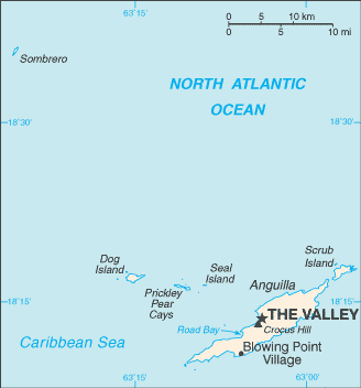
Map of Anguilla
|
- Administration :
Anguilla is a British internally self-governing overseas territory. It has a constitution : the Anguilla Constitutional Order of 1 April 1982 (amended 1990). The Governor of Anguilla is the representative of the Queen. He has to appoint the Chief Minister of Anguilla's elected government and he personally deals mostly with foreign affairs and economic issues.
Top
|
Geography
Anguilla is a Britannic territory located in the Leeward islands (northern islands of the Lesser Antilles) to the North of Saint-Martin (France and Netherlands). The primary and secondary sectors (agriculture and shipbuilding) have lost their past importance while the tertiary sector is expanding rapidly. The breeding of cattle, lobster fishing , salt production, tobacco farming and traditionnal activities are replaced by tourist industry which brings to the island more than half its revenue.
- Main towns :
Blowing Point, The Valley
- Main islands :
Dog, Prickley Pear, Cays, Seal, Scrub, Sombrero
Top |
Localisation
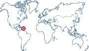
18°15 N, 63°10 W (1)
Zone : Amérique Latine et Caraďbes
Top
|
History
Settled by the British in 1650, Anguilla was united with Saint Christopher and Nevis against its will for administrative reasons.
Several separation attempts took place but suffered a defeat. United Kingdom tried to merge Saint Christopher and Nevis (having internal autonomy) with Anguilla. At that time the inhabitants of Anguilla revolted and in 1971, Great-Britain granted Anguilla a separation from Saint Christopher and Nevis : while Saint Christopher and Nevis became independant in 1983, Anguilla remained British and became in 1980 an autonomous overseas territory with a legilative house, a governor and an executive council.
Top
(1) These coordinates are approximate.
(2) Pour ce qui est des TAAF et des îles éparses, ce nombre varie trčs souvent. Leur population donnée ici n'est donc qu'une approximation trčs imprécise fournie ŕ titre purement indicatif.
(3) ZEE : Zone économique exclusive. Ces chiffres sont approximatifs.
|
|

 Akrotiri & Dhekelia